Guests: Eva H. and Ashley H., California
Travel Dates: July 2013
Destinations Visited: Lima, Cusco, Sacred Valley, Salkantay Trek, Machu Picchu
Machu Picchu – the lost city of the Incas – is on everyone’s bucket list, right? It’s been on mine for years.
There were several options available:
- Take the train from Cusco to Machu Picchu – seemed a bit lame for such an iconic trip;
- 3 or 5 day Inca Trail – camping in the middle of winter, not so appealing + the prospect of 500 tourists beginning the trek each day, not so special;
- But then voilà! I found the Luxury Lodge Salkantay Trek to Machu Picchu, an ancient path less traveled that approaches Machu Picchu from the west. Hmmm, this looks interesting. A 7 day luxury lodge to lodge trek to Machu Picchu – trekking between four mountain lodges in the Cordillera Vilcabamba range. Hello glamping!! No tents! Booked!!! Worry about the walking component later …
The Salkantay Trail (which is longer and reaches higher elevations than the Inca Trail Trek) takes its name from Salkantay Mountain, which at 20,574ft (6,271m) is higher than any peak in North America.

Salkantay Mountain
The trail winds through the Salkantay Valley – as we climbed over high Andean passes we experienced the most amazing scenery of wonderful ruins, glaciated peaks, rocky moraines, icy creeks, cloud forests, deep valleys and charming mountain villages. The scenery changed as we descended in altitude – the trail passed through coffee, avocado and banana plantations, lush orchards and dense forests en route to the legendary ruins. The entire journey was breathtaking.
Machu Picchu was built around 1450 at the height of the Inca Empire.Why it was abandoned just over 100 years later remains a mystery. Quechuans (native Peruvians) blame the Spanish conquistadors for the genocide of their ancestors but historians believe that the conquistadors never discovered Machu Picchu as the sacred rocks defaced by the Spanish in other locations are untouched at Machu Picchu. It’s more likely that the majority of Incas died from smallpox.
American Hiram Bingham is credited with re-discovering Machu Picchu in July 1911 but an engraving found in one of the temples suggests that Augustín Lizárraga, a muleteer, came upon the site in 1905.
On the eve of our journey Ash and I met our guides Manolo and Danny as well as our fellow trekkers:
- Margaret and Rodney from the UK
- Melanie and Eric, power couple from NY’s upper west side
- Betsy and Joel, Arizona lawyers & their children Leah and Josh – about the same age as Ash
- Alex and Christina, school teachers from Liechtenstein
Here is an account of our journey!
DAY 1: Cusco — Soraypampa
Let’s go! Hotel pick up – 7:15am
Arghh!! Road works – after the wet season, the main highway (2 lanes!) from Cusco is in a constant state of repair. It’s a 90 minute delay, but it affords us a distant view of Salkantay – seems surreal that on Day 3 we’ll be climbing to the pass below the peak.

Tarawasi Ruins
En route we stop to visit the recently discovered Inca ruins of Tarawasi near the town of Limatambo. This site is believed to have been a trading post between the highlands of Cusco and lower lands towards the coast. The precision of the dry walls is very impressive. It’s impossible to wedge even a blade of grass between the fitted stonework. Unbelievable!
We also stop briefly at the mountain village of Mollepata before heading to Marcoccasa where we begin our trek. This is it!

View from Camino Real
We follow the Camino Real (Royal Path) and the Inca water duct system that still irrigates farmland between Soraypampa and Mollepata. The trail is extremely picturesque and the gentle incline makes for a relatively easy 2½ hour walk. We rest for a few minutes at Challacancha to enjoy magnificent vistas of Humantay and Salkantay Mountains. Ahead we face a 60 minute steep rocky incline. At times the path is particularly narrow (as little as 10 ins/25 cm – the horses and donkeys carrying our duffel bags, food and equipment don’t seem to mind) with a sheer drop to the Apurimac River Valley below.
So far my legs are OK – breathing, not such much. I dare not complain – despite a bout of TD, Ash manages to keep up. She’s such a trooper – no solids – water and Gatorade her only friends for the past 2 days. Lesson learned: beware ice-cubes and frappés in foreign lands!

Salkantay Lodge
There’s a respite ahead – the trail returns to a gentle incline – it’s another 90 minutes before we reach Salkantay Lodge. We encounter no-one on the trail – fabulous!
The lodge is amazing and completely exceeded our expectations – nestled at the base of the mountains the views from our room are spectacular. We watch Humantay and Salkantay turn pink in the sunset and then the starry night sky – magical. We’ll be here for 2 nights.
- Temperature: 45/70F 7/22C
- Trekking Time: 5 hours
- Distance: 11 miles 17 km
DAY 2 — Soraypampa

Humantay Lake
After an early breakfast, we leave the lodge for a 2 ½ hour hike uphill to Humantay Lake. It’s a little chilly to say the least! At first the walk took us through rural pastures populated by small herds of cattle but then the terrain became rugged and extremely steep – used hiking poles today – not sure whether they really helped physically but psychologically it was good to have them!
We reached the first of two punas (plateau) – a short break and an opportunity to enjoy the incredible view of the Vilcabamba Valley behind us – the sense of isolation increased before one final steep climb to reach the second puna and a view of the glacial lake below. It was a perfect day – the water was glistening blue with a backdrop of sheer rock and tumbling ice. Just stunning! It was a little too cold for a dip in the freezing lake although Josh jumped right in (and out)!

Vilcabamba Valley
It was heaven to simply bask in the sun and take in this spectacle. We also spotted a condor (very) high in the sky above, a little too far for a photo opportunity.
The descent was challenging – steep, rocky, narrow paths but much faster paced than the ascent. We made it back to the lodge in less than 2 hours – in time for a late lunch.
Feeling really good after lunch, so I ventured out for a 60 minute walk (on the flat) before my massage (yes, massage – all the lodges offer this amenity!) in readiness for Day 3 – the BIG one!
Is it now that I mention how fabulous our chefs were – the food so far has been amazing! After dinner we were treated to a Pisco Sour demonstration – Peruvian pisco, lime juice, sugar syrup, egg whites and a few drops of Angostura bitters. Delicious – my new favorite drink!
- Temperature: 25/65F -4/19C
- Trekking time: 5 ½ hours
- Distance: 7 miles 11 km
DAY 3 — Soraypampa to Wayraccmachay
THE BIG DAY!

River Crossing on Salkantay Pass
Today’s agenda: hike up the Rio Blanco Valley circling Humantay Peak to the highest point on the trek – Salkantay Pass at 15,213 ft/4,638m. From there descend towards Wayra Lodge. Seemed straight-forward…
Poor Ash – she was certainly not well, she was completely spent – it would be impossible for her to attempt today’s arduous journey on foot. Such a shame, but the good news – she can continue the trek on horseback with one of the wranglers – we’ll meet up with her at the next lodge. Her journey would prove to be an uncomfortable 4½ hour horseback ride along steep rocky trails. And hair-raising – did I mention that the horses and donkeys routinely walk along the outer edge of the narrow paths? Not an inch between their hooves and the rim of the path – remember those sheer drops to the abyss?!
This isn’t too bad at all – not understanding why this is reputedly the toughest day of the trek. Start of the hike was a very gradual ascent through sunlit grassy pastures, birds chirping, a wide trail, passing by winding rivers and the occasional farmer – all very pleasant.

Switchbacks to Salkantay Pass
The answer came within 30 minutes – the steep ascent had begun and the terrain became tougher. It’s another hour before we make it to Salkantaypampa – 13,625 ft/4,154m. Uh-oh, another steep ascent…. We make it to the next puna, but we’re not done. As we got higher, the mountains began to open up around us, with snow-capped peaks in every direction.
After crossing the river, we face 15 uphill switchbacks – OMG!!
The trail narrowed and began a seemingly never-ending zigzag into the mountains. The higher we climbed, the steeper it became, the hotter I got! I began stripping layers of clothing – down to trekking pants and a t-shirt despite the almost freezing temperature and at times gale-force winds straight off the glacier. I soon reached slower than snail pace while struggling to breathe but there was no turning back.
Tip from our guide Danny – sing James Brown’s song:
“I feel good – I knew that I would now – so good, so good …”
It actually worked – but the trick was to multi-task! Singing the lyrics (in my head of course!) while remembering to breathe was a challenge! I was thankful when we were finally done with the switchbacks.
We make it to Soyrococcha – 14,730 ft/ 4,491m. It’s time for a longer rest and more sustenance. It was now much colder and windier – so time also to add some layers of warmth. Looking to the valley below it was breathtaking (literally) to realize how high we had climbed in the past 4+ hours. The clouds were just above our heads – the pass not too far away.
We made the final push to the pass – another 500 ft/150m steep ascent. It was a case of just putting one foot in front of the other and keeping that breathing going.

Salkantay Pass
Then, low and behold – at 15,253 ft/4,638m the Salkantay Pass – we made it!!
High 5’s all around!
At this moment we were literally in the clouds and at the end of the hardest part of the trek. It was an amazing feeling. We were surrounded by incredible views of snow-capped peaks of the Vilcabamba Range in all directions – the south face of Salkantay was looming massive beside us.
What an accomplishment – I felt totally elated! Such a shame I couldn’t share this moment with Ash but I took some solace in knowing that she too had made it to the pass and experienced the grandeur of Salkantay earlier in the day.
Words fail to describe what we see and unfortunately my photos simply don’t do justice to the sight before us – but I do hope you get a sense of the magnificence that is the Andes.

Rock tributes on Salkantay Pass
After taking the requisite evidential photos – and there are mountains of them (no pun intended) – we started the fairly steep descent down the other side of the mountain – the landscape changed dramatically. Green valleys appeared far below us, with our immediate surroundings marked by scattered granite. We continued our descent for two hours to Ichupata – 13,799 ft/4,207m – and came upon a marquee pitched in the middle of no-where – our hot lunch is about to be served! Extraordinary and somewhat surreal!!
We continue on the rocky decent for another hour. Glaciers loomed above us on both sides of the valley that became increasingly green ahead of us. Uh-oh! The side of my foot felt a little “tender” – blister alert!! Lots of bandages and strapping and I was good to go. Thankfully blister averted.
After a long but exhilarating day, we finally arrived at Wayra Lodge!
- Temperature: 20/60F -7/16C
- Trekking time: 8 hours
- Distance: 8 miles 13 km
DAY 4 — Wayraccmachay to Colpapampa
It’s a fairly short trek today – 4 hours – a welcome relief from yesterday’s epic journey.

Salkantay Trail
As we trek downhill above the Salkantay River, the dramatic change in scenery continues. We leave behind snow-capped peaks, rocks and ice. It becomes increasingly green as we head for the outskirts of the Amazon jungle.
It’s mostly downhill today which you might imagine is easier – not so. It’s very steep, there’s lots of gravel and it’s very slippery … very tough on mid-century knees! Thank goodness for the hiking poles. Everyone’s concentrating on keeping upright – thankfully, no spills.
Ash joins the group on foot today, but into the third hour takes a shorter route with one of our guides to get out of the midday sun.
We finally reach the canyon floor and cross the river. We continued down to the Santa Teresa River Valley through somewhat more populated rural areas with coffee plantations, orchards, bamboo, thick vegetation and the occasional hummingbird.

Colpa Lodge
There’s one final rocky and steep climb before we arrive at Colpa Lodge.
We enjoy a late lunch – Pachamca – a special Peruvian treat usually reserved for birthdays and other festive occasions where the entire meal is prepared in an underground stone oven. Delicious assortment of meats and vegetables – yum!
We spend the afternoon relaxing in deck chairs by the extra large jacuzzi and take in the views of the surrounding mountains and down to the convergence between the Salkantay, Chalan and Totora Rivers.
- Temperature: 50/75F 10/24C
- Trekking time: 4 hours
- Distance: 6 miles 9 km
DAY 5 — Colpapampa to Lucmabamba & Ziplining

Zipline
Ash is feeling better today – just in time for a change of pace. Ash and I are going off-route to enjoy a day of zip lining!
We trek downhill for an hour toward the Santa Teresa Valley passing coffee plantations as well as beautiful orchards filled with bananas and granadillas (a type of passio nfruit). After crossing the river and a 30 minute ascent to the dirt road, we say goodbye to our fellow travelers.
It’s so strange not to be walking! From the small village of Loreta, we take a mostly bumpy, and sometimes hair-raising 90 minute van ride (the van comes perilously close to the edge of the dirt road – the driver not the least bit concerned) following the river to Cola de Mono Zip Line, just outside the small town of Santa Teresa. It’s a gorgeous spot – a resort in the middle of the jungle.
There are 6 zip lines here – can’t wait! After an arduous 45 minute climb to the highest platform we’re ready to go! Zip-line 1: Ash did really well – I came in like a bat of hell and slammed into the face of the escarpment – soles of my feet first, hiking boots on, so all good. Note to self: apply the brake a little harder!!
5 lines to go, each line separated by a 10 to 20 minute trek. Zipping down through the Andes, reaching speeds of nearly 40 mph/65kph, taking in the absolutely stunning surrounding landscapes, rivers, and valleys below – what a great day and so much fun!

River Crossing on Salkantay Trail
After a 45 minute ride, we reach the start of the Llactapata Inca Trail – it’s a well maintained terraced section of the original Inca Trail that takes us through dense coffee and banana plantations. It’s hot and humid – we’re definitely in rainforest territory. Lucma Lodge is only an hour’s trek away. Nestled in an avocado orchard, it’s another divine setting.
Before dinner we explore the small town of Lucmabamba and visit with a local coffee farmer. We were intrigued to watch the entire process – an espresso from dried bean to cup.

Lucma Lodge
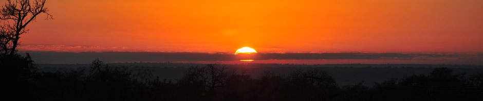
Another beautiful sunset – glowing orange over the dense tropical forest, illuminating the now very distant peak of Salkantay.
- Temperature: 60/82F 16/28C
- Trekking time: 4½ hours
- Distance: 11 miles 17 km
Day 6 — Lucmabamba to Aguas Calientes

Llactapata Pass with guides
The final day of our trek starts early – before dawn. It will be tough day – a 2,000 ft/610m ascent followed by a 3,000 ft/915m descent – hiking poles at the ready!
The trail follows the contour of the mountain through dense forest vegetation. As we scramble higher we glimpse views of the valley below. 2 hours in and we’ve reached the first plateau – time for a much needed rest, drink and snack! We were shocked to come upon another group of trekkers – it’s so strange. It’s the first time in 6 days that we have seen other trekkers up close!

Llactapata Ruins
Our uphill battle is not yet done – we still have an hour before we reach Llactapata Pass. Surprisingly, Llactapata is rarely visited – the mostly restored ruins here were only recently discovered. It is said that this complex was of great astronomical importance. It shares a special connection with Machu Picchu – the sunlight lines up on certain points of the two ruins.
We marvel at the distant, but very unique view of the Machu Picchu citadel. So close and yet so far – we could see some of the outer agricultural terraces and Huayna Picchu – we would have to wait one more day. But no-one minded. We’re in forest-clad mountains, the sky is blue – all’s good.
Everyone’s ready for lunch in the “observatory” with a view of Machu Picchu just a mountain away…. BTW, it’s another hot lunch. Our (traveling) chefs, Luis and Julio, are simply amazing!
There’s not much time to rest after lunch – we still have a drop of nearly 3,000 ft/915m via 63 switchbacks to conquer – that’s at least another 2 hours. And for the first time, we’re on a real deadline: we have a train to catch!

Tropical flowers on the trail
It’s hot and really humid – we’re now trekking through lush bamboo forests, passing more orchards and coffee and mango plantations on our final descent to the Machay Huayco River. We cross the river in pairs via a rope suspension bridge. I couldn’t help myself…about the middle of the bridge I started jumping (of course it was safe), the bridge started swaying – needless to say, Ash was not impressed. It may have been a juvenile moment (blame the heat) but I found it terribly amusing!
Our final descent is difficult, slippery and steep but with beautiful views of the Rio Vilcanota Valley. We continue to the hydroelectric station where we take a train to Aguas Calientes, the town of Machu Picchu. It’s a little sad that our trekking journey is over.…
Apart from our encounter earlier today with other trekkers, it’s the first time in almost a week that we are surrounded by tourists, hundreds of them! We’ve been so spoiled on this trek – we’ve virtually had the mountains to ourselves…we’ve been completely engulfed by nature.
- Temperature: 60/80F 16/27C
- Trekking time: 6 hours
- Distance: 13 miles 22 km
Day 7: Machu Picchu
Today’s the day! We get an early start and hope for clear skies so that we can witness the sun rising over Machu Picchu. It’s a 30 minute bus ride above the Urubamba River to the entrance.
Our timing is perfect. Within minutes of our arrival the sun rises over the mountain peaks surrounding the Inca citadel – breathtaking! A private 2 hour guided tour gives us the opportunity to experience the beauty of Machu Picchu before the crowds arrive. And they do – it’s estimated 4,500 tourists visit the site daily. Now it’s time to explore the ruins independently on this perfect balmy day.
The ruins, perched on a small hilltop in the Andean Mountains, are spectacular!
The majestic city sits more than 5,300 ft/1,600m above the Urubamba Valley. There are almost 200 distinct buildings – 70% of which remain intact – built around a vast central square. The city is divided into three zones – agricultural, urban, and religious. The agricultural terracing and aqueducts take advantage of the natural slopes; the lower areas contain buildings occupied by farmers and teachers, and the most important religious areas overlook the lush Urubamba Valley thousands of feet below. Numerous stone stairways allow access to the different levels across the site. The residences, temples, storage facilities and public areas are built mainly from blocks of granite.
Words fail to describe these incredible ruins. Hopefully our photos will give you some sense of the scale and grandeur of Machu Picchu. The history of Machu Picchu remains a mystery. As we explored the ruins we wondered who the Incas were, how and why was this city built, when was it abandoned? What really happened? No-one knows for sure.
Late in the afternoon we take the train to Ollantaytambo, before returning by road to our hotel in Cusco. Our journey is over.
We were indeed fortunate. We shared our journey with a great group of people and wonderful and caring guides. Let’s not forget the cooks – they prepared amazing cuisine throughout.
Our journey was long and challenging – both physically and emotionally (okay – difficult days, pampered nights). The experience of hiking the Salkantay Trail was incredible – it was difficult not to be overwhelmed by the breathtaking scenery as we followed the path of the Incas. The trail was perfectly orchestrated to end with a visit to Machu Picchu – stunning!